
SatGazer – Track the satellites that orbit the earth
SatGazer is a software that provides rich visualizations for the positions of satellites in different ways on a map with footprint and predictions. Download a collection of TLEs (orbit data) via the downloader in the app and select the satellites you are interested in. SatGazer then displays the selected satellites on a map and shows the trail for the focused satellite. It also displays the footprint for the satellites. If you want to observe or receive satellites – for example receive weather data from NOAA satellites -, SatGazer offers different ways to plan your observation. You can also export future passes of satellites as a formatted text document.
Platforms
SatGazer is available for macOS 12.0 (Monterey) or later
Details
Every satellite has an individual color, that is calculated with the satellite ID, so it is consistent in all views and stays the same at every startup of SatGazer.
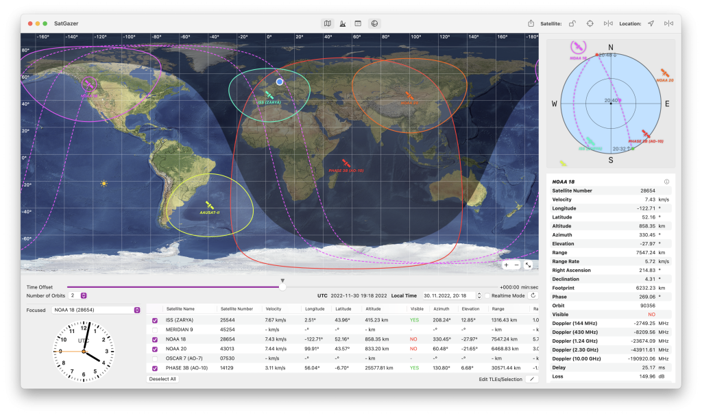
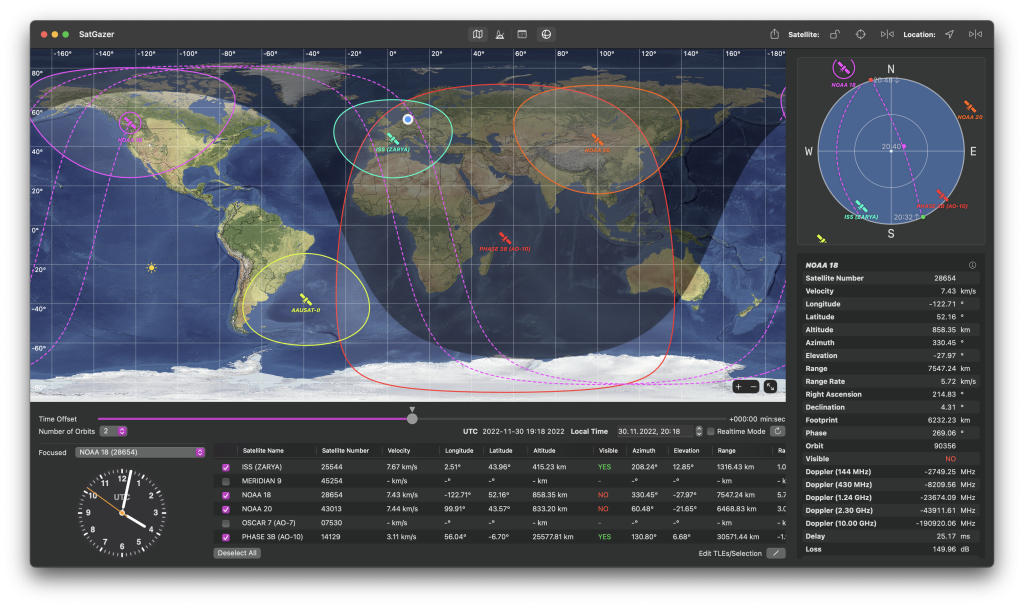
The UI entirely adapts to dark and light mode.
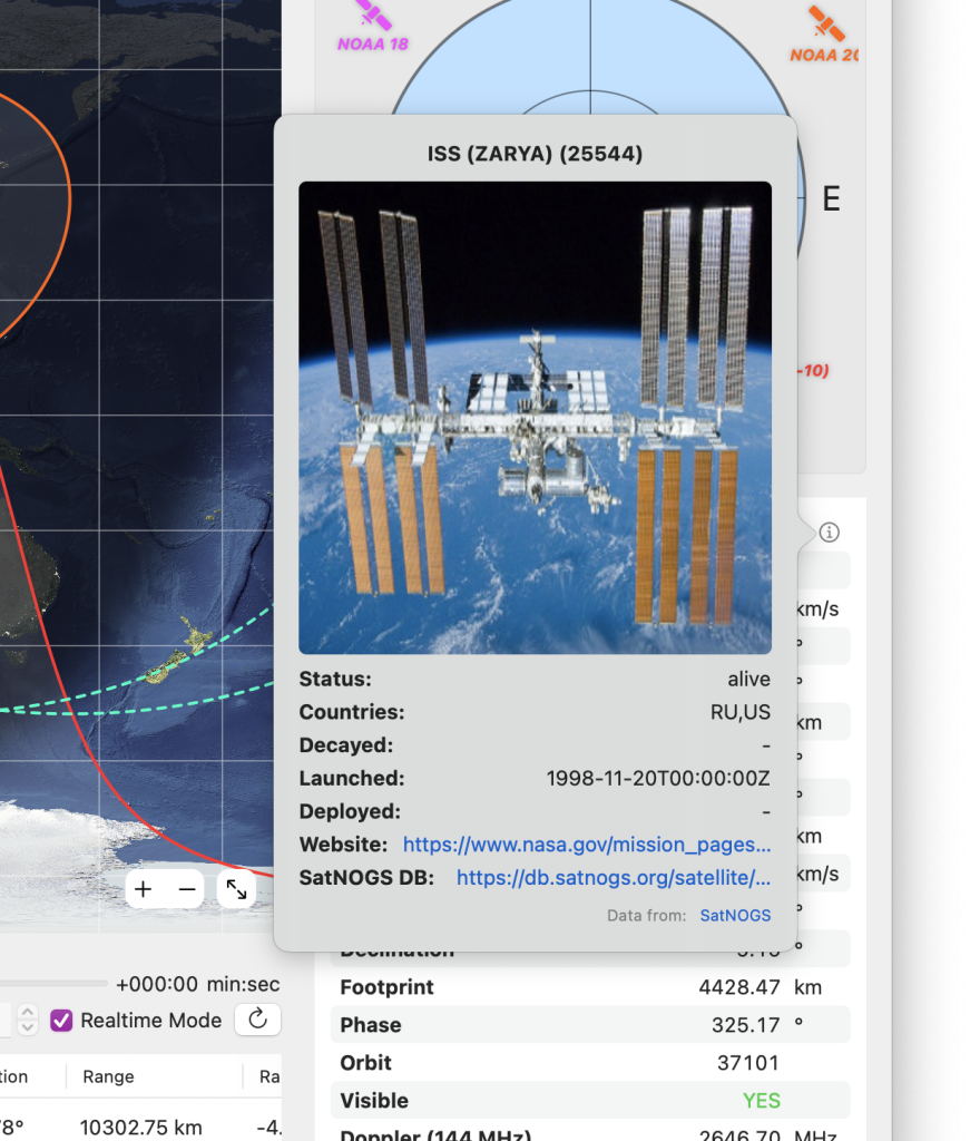

SatGazer displays detail information from the SatNOGS Api. Most satellites, that are interesting for amateur radio purposes, are listed in the SatNOGS database with an image and some additional information like the launch date and the status of the satellite. SatGazer presents this data.
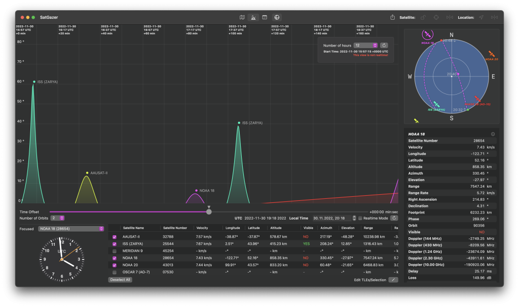
In this view SatGazer visualises the passes of the observed satellites with the elevation at a given time. Due to individual colors for every satellite, you can easily distinguish the different satellites and look for passes that could be interesting for you.

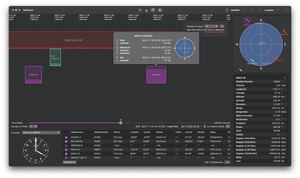

For planning your observations it is very helpful to have a more compact and detailed view for future satellite passes. So SatGazer has a view, that presents the future passes in a timetable like view. When you click on a pass, you can get even more information e.g. a little radar view. The filling level indicates the maximum elevation, to see the relevant passes at a glance.
The TLE manager/downloader makes it easy to manage and download the TLEs from the web or import a text file with TLE data.


